Construction Industry Webinar: From Code to Compliance – Mastering the Building Safety Act 2022
Join us for our upcoming live webinar – “From Code to Compliance: Mastering the Building Safety Act 2022” 🗓️ Date:
Read articleImagine you’re an MMA fighter, and you want to find ways of improving your technique and training plan. Not many people would think to consider an analytics tool to help them do this.
This was the example I presented at the Qlik Analytics Tour to demonstrate Qlik GeoAnalytics. I practice MMA fighting and a BI graduate on my team came up with this as an idea for a use case. So how does analytics come into play with helping an MMA fighter step up his game?
Qlik GeoAnalytics is a revolutionary advanced analytics tool that reveals vital, geospatial information and exposes hidden geographic relationships so you can make better location-related decisions.
However, when I talk about Qlik GeoAnalytics, a lot of people only consider it in terms of locations and maps. What I wanted to do was demonstrate just one of the huge range of potential use cases that GeoAnalytics can be used for.
For our MMA fighting example, we start with fighting venues from around the world. The bigger the venue, the bigger the marker on the map. As we can see, if we hover over a marker, it will show us an image of the venue. Our fighter, Kevin Marsden, is ambitious and wants the biggest venue in the world for his next fight. To find this out, we use Geospatial Analytics.
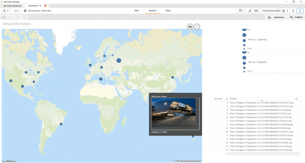
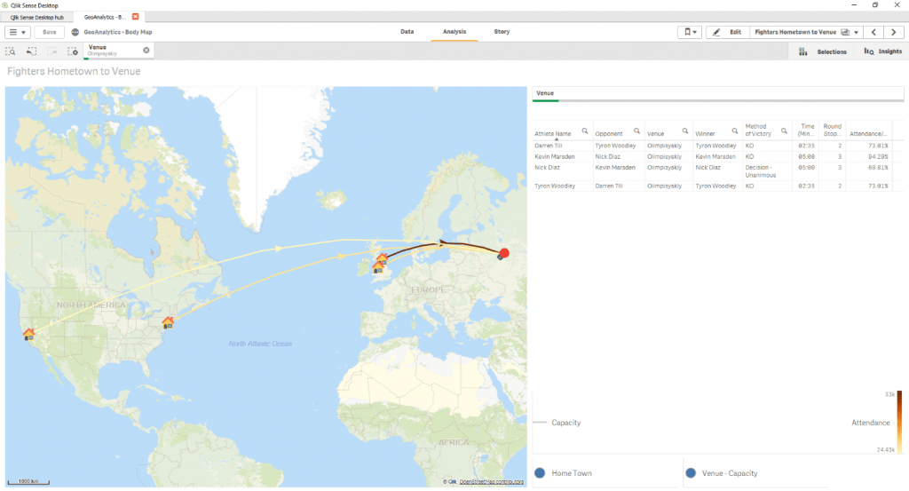
The biggest venue they can fight in is the Olimpiyskiy National Sports Complex. Once we have that information, we can find out who would be the best opponent by mapping out the fighters from around the world who have fought at this venue. The darker the arrow, the better their attendance to maximum capacity ratio, meaning the bigger audience they had and the better draw they have for future fights. In this case, it’s Kevin Marsden.
We then take an image of an athlete’s body, our MMA fighter. We can see a list of athletes’ names and their potential opponents. With Qlik, the colour green is your selection and grey is what you haven’t selected, so you can visualise all of your data and find connections you might otherwise miss. We can analyse Kevin’s most recent fights, his opponents, and who won.
To help our fighter improve his technique in the future, we can divide up the image of his body into limbs, to map out his body. From there we add in the data from his last fight, the only one he has lost, of how many times he was hit and where. Qlik takes that data, reams of complicated numbers, and transforms it into an easy-to-use visualisation. We can quickly learn that his weakness is defending his legs, particularly his left side. That, for an MMA fighter, is a massive discovery.
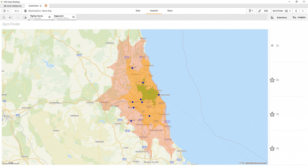
So, the fighter now knows he needs to step up his training plan. He wants to join a gym – but which one? We can again use Qlik to map out the local area around the fighter’s house to see which are most convenient.
We can narrow down the gyms to within a certain radius of how far he’s willing to travel. We have the choice of doing that by distance travelled, or by drive time (much like your sat nav would do). This is an important distinction to make. Travelling distance is as the crow flies, so five miles in London is going to take a lot longer than five miles in Newcastle. Drive time is far more efficient and useful. In this example it is mapped out in 10, 20, and 30-minute distances, however, we could map out the gyms by size, by how many MMA fighting champions use the gym, by the gym’s rating, or by its specialities.
All of this information goes towards empowering our MMA fighter. He knows his strengths, his weaknesses, and the best, most convenient way of training more. He can make data-backed decisions about his fighting style and finding the best way of improving his performance to step up his game.
Moving away from the MMA fighter example, just think about what this could do for your business. Anything that’s an image, Qlik GeoAnalytics can map out. Cars, bodies, venues, locations, properties, branches of a shop, the ocean, anything you like.
I’ve had customers where we’ve mapped out their factory floorplan and find the quickest route from one area to another, or the average walking time between areas. You can also find any pinch points or bottlenecks in corridors, for example. We’ve had another customer in retail where we mapped out their shop to help find the optimal layout for product placements.
The BI consultants at Cybit have designed and tailored many Qlik solutions to the exact needs of the business we’re working with, even if they had thought it would be too specific to achieve.
Mapping out data can help you to see new insights by seeing your data in a totally new way. You simply wouldn’t get that by combing through Excel sheets packed with numbers. It also helps non-analysts to understand complicated data so your whole team is armed with knowledge. The possibilities are endless, and just depend on the industry you’re in and what you’re trying to achieve.
We understand there are many options to choose from and you want to make sure the tool you adopt is the right one for you.
"*" indicates required fields
Construction in Crisis! Written by Chrissie McAnelly, Cybit Data & Analytics Consultant – Construction Sector The construction sector is
Read articleBy Asiel Esgair – Cybit Data & Analytics Consultant – Public Sector & Local Authority In our
Read article